Enjoy this enchanting Hampshire walk around Hazeley Heath and Mattingley. Visit a timber framed 15th century church and walk alongside the beautiful Dipley Mill Gardens, a former 16th century Mill. Discover a wartime pillbox and tank training remains, while exploring woodlands, heathland and a lily pond.
OS Map

Download the route to your own device
Download GPX route for use with OS Maps, Map my Walk, Map my Run and many other mapping apps.
Download KML route for use with Google Maps
How to add the route to your own map
Click the appropriate download link above to download the route to your device. Open the app/map that you want to use it in and upload the file to create a new route.
How to import a KML route into Google Maps
- Download the above KML file
- Open Google Maps
- Select the Menu
icon in the top left corner
- Scroll down the list and select “Your Places”
- This opens a new pane with 4 tabs across the top, select the Maps tab.
- At the very bottom of the pane click on “Create Map”
- Click “Import” and upload the KML file (probably in your download folder).
Distance: 6.9 miles
Parking: There is limited free street parking in Plough Lane, Hazeley.
Alternatively – start at Hartley Wintney. Park in the village and start your walk by heading north along the B3011 to join the route.
Hazeley Heath and Mattingley: An enchanting historic walk in Hampshire.
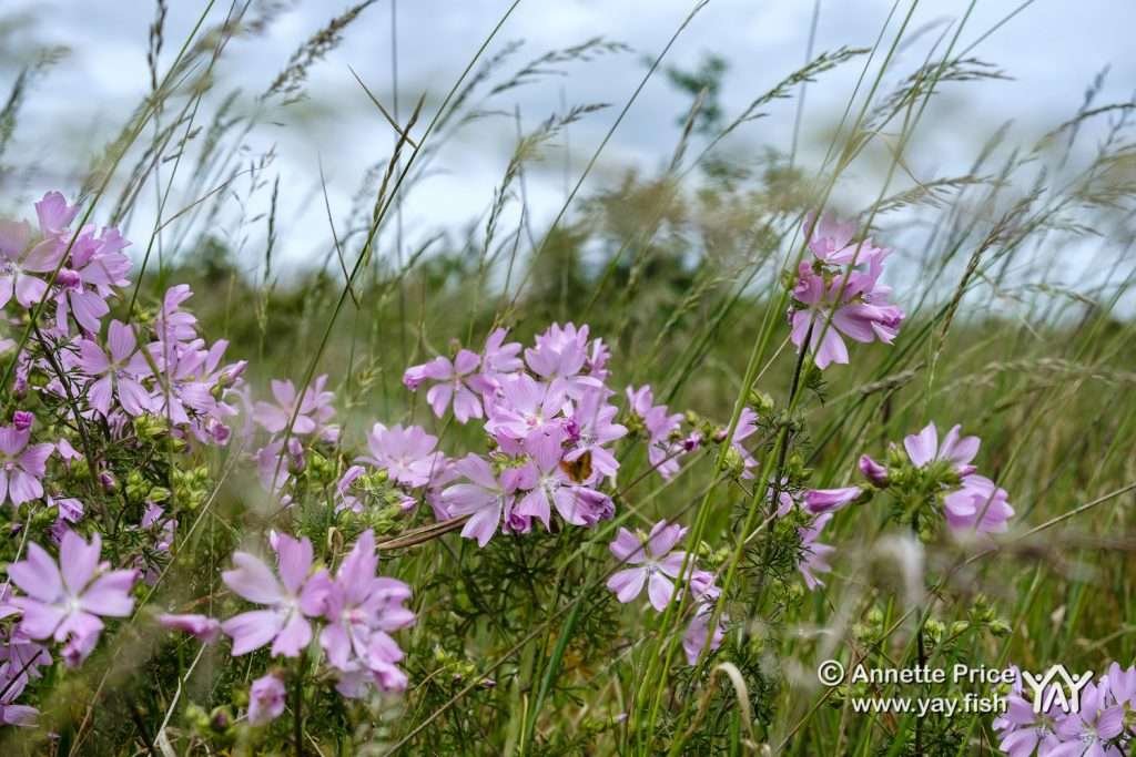
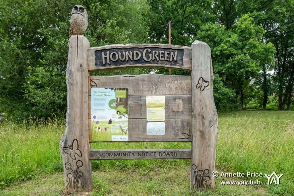
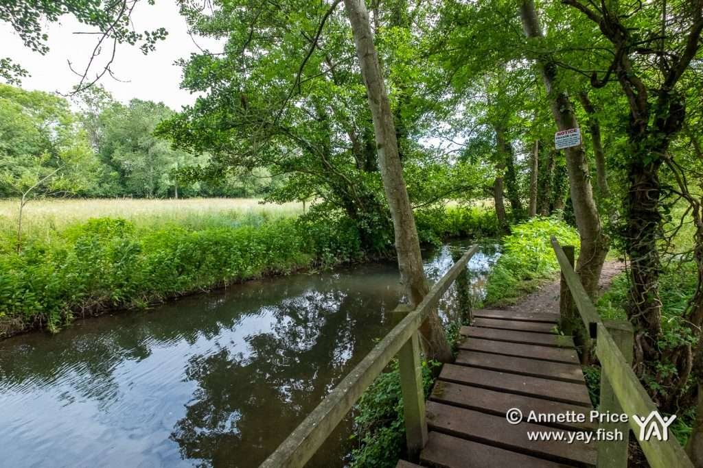
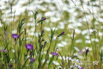
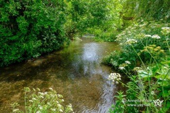
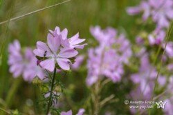
This walk begins in Plough Lane, near Hazeley. Leave the road and head into woodland. The path emerges into meadows of wild grasses, purple flowers and clover. Continue through Hazeley Lea, past Elder Moor Farm, over a couple of footbridges crossing the River Whitewater to arrive at the village green in Hound Green. Here there are tables with carvings of butterflies, flowers and frogs on the chunky table legs, ideal for a family picnic on a sunny day
Hound Green

Continue onwards towards Mattingley through woodlands and alongside crop fields.

Mattingley Church

At Mattingley, in the grounds of a well kept garden and cemetery, you’ll find Mattingley church. A grade 1 listed building, built towards the end of the 15th century. A church has stood on this spot since the 14th century or possibly even earlier. Pope Martin granted a licence for the cemetery to be built next to the church in 1425!
Mattingley church is a timber frame building with a red tile roof and bell turret. The spaces between the timbers are filled with red bricks forming a herringbone pattern known as brick nogging.
A bench facing the church is an ideal spot to stop and eat lunch, while enjoying the tranquility the church and gardens offer.
Unfortunately, at the time of writing this, we couldn’t go inside the church because it is still closed due to the coronavirus pandemic.
Under Invasion. The Himalayan Balsam.

Pretty but invasive
The Himalayan Balsam is a very pretty but invasive plant species and during the summer months you will see it on this walk. In July, beautiful, orchid-like, pink flowers cover its lush green leaves.
It crowds out native plant species
It was introduced into the UK in 1839 as an exotic greenhouse plant. But it quickly escaped and now thrives along river banks, crowding out native species by growing in thick bushes that can reach 3 meters tall. It has a very clever projectile mechanism for releasing its seeds. The seed pods literally explode open when touched or brushed against, propelling the seeds for up to seven meters away and creating dense coverage very quickly.
River bank erosion
The Himalayan Balsam is an annual plant and so dies back over winter, leaving no roots to hold the soil together. This causes river bank erosion and flooding.

Pull Snap Stomp
The Inland Waterways Association poster encourages walkers to pull up a few flowering Himalayan Balsam plants during their walk. To do this, grip individual plants at the base and pull, snap the root off and leave them in a pile away from the path to rot down. If you create a big pile, then stomp on it to speed up the rotting down process. We found dense bushes of the Himalayan Balsam plant growing beside rivers and ditches during our walk and we did pull, snap and stomp a few plants.
Once the seeds have started to develop, don’t touch the plants or you will spread the seeds to other areas.
The following advice is from The Inland Waterways Association
- Pull – Check our Himalayan Balsam identification guide to be certain that it is Himalayan balsam and then pull up individual balsam stems – they pull up very easily,
- Snap – break off the root below the lowest growing node,
- Stomp – Put into a small pile to rot down, away from the path. Bigger piles can be stamped on to assist the rotting process – small children love doing this and it makes a great popping sound!
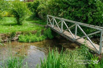
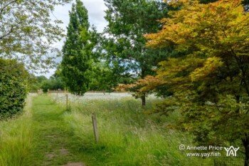
Continue onwards, the path meanders through grasslands and then suddenly changes in character. A field of white flowers and wild grasses, beyond which, are two giant tropical palms swaying gently in the breeze. The footpath takes you closer to an old house and a small bridge crossing the River Whitewater. You are now at Dipley Mill and surrounded by beautifully manicured gardens and an exotic mix of plants.
Dipley Mill Gardens
Click on the above pictures to see them larger……
Dipley Mill Gardens is currently owned by garden designer, Rose McMonigall, who in 2000, completely renovated the previously dilapidated garden, creating 18 ‘rooms’ which include many unusual and specialist plants and trees.

A wartime pillbox is engulfed in plants and incorporated into Dipley Mill Garden. From inside the garden, a spiral staircase takes you to the roof of the pillbox for a bird’s eye view.
The 16th century Dipley Mill was one of six flour mills along the River Whitewater. It’s listed in the Doomsday Book as part of the estate of ‘Alfsi, son of Brictsi’ It had a bakery next door, which later turned into The Old Mill Inn. In 1927 the mill was converted into a country house.
Dipley Garden has been featured on Gardener’s World and usually has public open days with a tea room. It’s currently closed due to Coronavirus pandemic, but the footpath cuts through the edge of the gardens and so you do experience some of its beauty during this walk. Dipley Mill Gardens.

The route continues through fields of wheat at sherwoods farm then into deciduous woodlands carpeted with a dense blanket of ferns, before climbing a short but steep bank, opening out into heathland and gourse.

Tank Training in an abandoned gravel pit.
At the top of the hill, follow the wide sand and gravel path until you reach the coiled tank tracks abandoned and rusting amongst the dust and vegetation.
During the second World War, much of Hazeley Heath was taken over by the war department and used as a tank testing and training area.
New tank designs were tested and captured enemy tanks were scrutinized to see what could be learnt from them. Tank recovery techniques were developed and practiced to be used in Africa and Europe as the war continued.
During the 19th and 20th centuries, sand and clay had been extracted removing substantial areas of gravel from the top of the hill. The WWII tank crews used the remaining gravel pits for training. The larger holes were filled in with landfill during the 1960’s and early 70’s.
But evidence of the tank training and testing still survive today…..


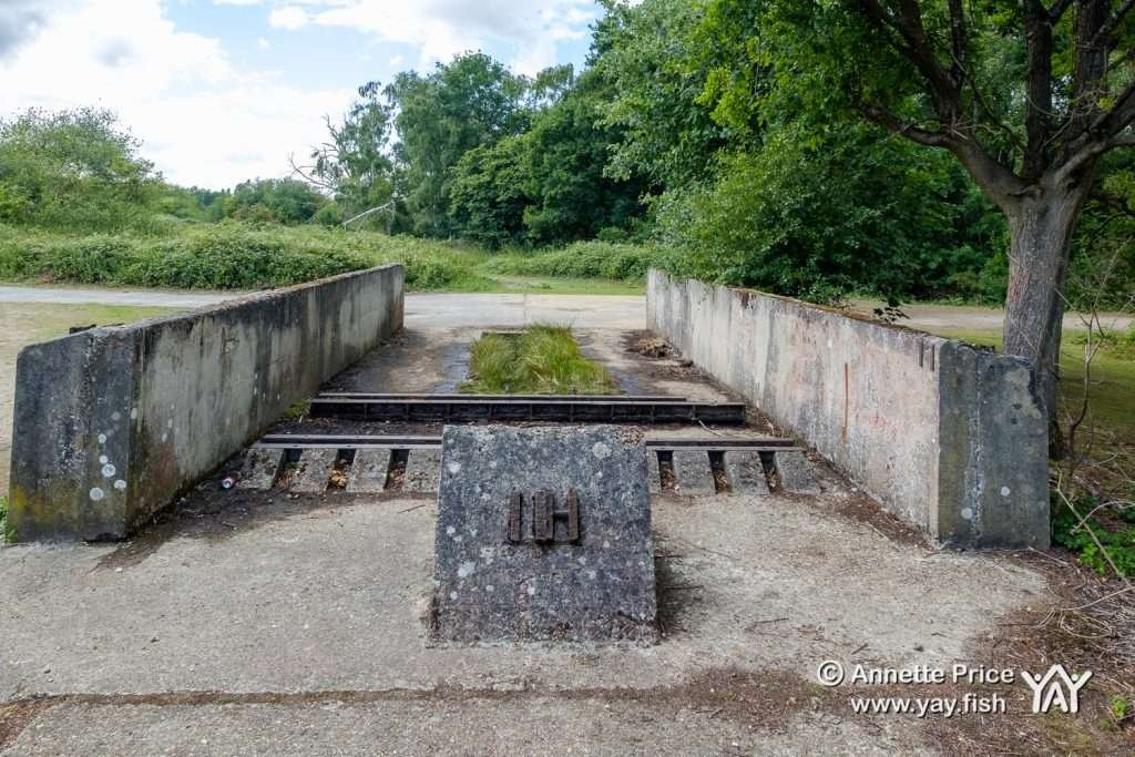
Testing tank recovery techniques.
The double walled structure (above) with a wedge at one end, once supported a powerful winch pulley assembly with a stationary engine inside the walled area. Carts were filled with iron to simulate the weight of a tank and hauled up the hill along a concrete ramp (below) to test tank recovery techniques during the Second World War.

Hazeley Heath - the heathland
Hazeley Heath is one of the largest areas of heathland in the region, although most has been lost over the last 100 years. Due to it’s rich biodiversity, it has become a Site of Special Scientific Interest (SSSI).
The heathland is home to a diverse range of wildlife including birds, reptiles and thirty species of butterflies, some of which are rare. Public footpaths criss cross the heathlands.


Follow the well maintained boardwalks through the heathlands, before the path changes in character yet again, returning to woodland and ferns.

Lily Pond
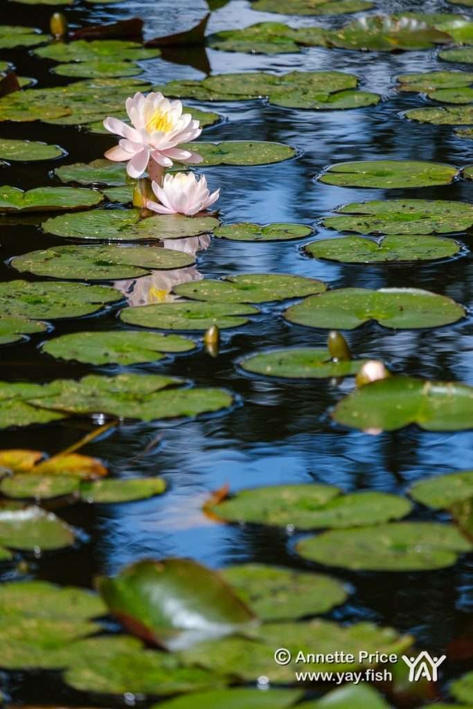


At Crabtree Lodge, there is a large pond decorated with white water lilies. A spacious lawn beside the water make this a good spot to stop for a snack, before continuing the loop to complete the walk.
Conclusion
Like much of North Hampshire, this walk has a mix of diverse and beautiful landscapes. From woodlands and heathlands to farmland and even a botanical garden, with opportunities to stop and picnic. It’s steeped in history as the walk visits the fifteenth century Mattingley church, the grounds of a sixteenth century mill, a wartime bunker and the remains of a WWII tank testing area.
Hazeley Heath is an SSSI site and so the wildlife, plants and flowers are beautiful, diverse and sometimes rare.
This walk begins at Plough Lane in Hazeley, but a good alternative starting place would be the village of Hartley Wintney. Park in the village and start your walk by heading north along the B3011 to join the route. Eventually, as the UK hopefully recovers from the coronavirus pandemic, we will be able to end this walk by visiting one the cafes and pubs in Hartley Wintney. That will be an idyllic end to a wonderful walk.
This page may contain affiliate links. If you click on one and purchase a product I will receive a small payment. This does not cost you anything at all but it helps me to continue creating content for this website.

Annette Price
About the Author
Annette Price. I am a wild places and adventure sports photographer, which means that I am passionate about getting outdoors, camping, caving, getting wet and muddy and photographing the landscapes and people that I find. Water is a big attraction for me and I love being in, on and under it and am a serial kayak paddler.I hope you enjoy the articles, kit reviews and photography on this website and that they help you to get outdoors exploring new places and activities.







Thanks for a great walk.
Thanks Russ, I hope you enjoy it 🙂 Let me know how you get on if you do this walk, I would love to hear your experiences.